

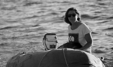
A J/40 races celestially to Bermuda
On the way back from Bermuda after the 2014 Newport-Bermuda Race, the inevitable “What’s next?” came up. Captain Dana of his J/40, Eagle, suggested we do the 2015 Marion-Bermuda Race . . . in the celestial navigation class.
For the record, my role as Eagle’s navigator is solely a function of nobody else will do it. My only celestial qualification was being owner of a plastic yard-sale sextant collecting dust in my basement, next to my “Learn Spanish” tapes. My only Spanish is “Hi my name is Joe and I have no Spanish.” My celestial skills were almost as good.
When the captain asked if I wanted to navigate next year’s Marion-Bermuda Race, I said “My name is Joe, I have no Spanish.”
To which he replied, “Great! It’ll be fun.”
How hard could it be? Vikings found their way around and they couldn’t speak Spanish either. So, I told the captain, “No problem, I’ll be ready. Piece of cake!” I dusted off the plastic sextant and within a few weeks I proved to my wife we were well north of the equator and likely in North America. She said she already knew that, but frankly, she had nothing to support her theory. I kept this to myself.
I turned to YouTube. I have learned more from YouTube than I ever learned in college, likely not the school’s fault. I also signed up for online classes. I could now impress my wife with terms like celestial sphere and names like Admiral St. Hilaire. She rolled her eyes a lot. Then, with the race still the better part of a year off, I went sailing, lost focus, and sort of put it off.
When the captain called to see how it was going, I told him I could prove we were in North America 8 out of 10 times. He took this as humility, “Keep up the good work!”
Meanwhile, I was repeatedly outbid on eBay sextants. I wasn’t worried, there were still 8 months before the race start. Then came ski season.
The next time the captain called, it was to let me know he was going to have the life raft inspected and pay the entrance fee. He seemed to want some assurance from me before he wrote the checks. I explained my view of the celestial sphere and threw in “line of position” for good measure. Impressed, he wrote the checks.
I tamped down a flash of panic by reminding myself that a very long time ago, people who couldn’t read figured all of this out. Deep breath.
With six months to go, real doubt was creeping in. How did those axe-wielding, people-chopping Norsemen figure this stuff out, and without YouTube?
Then, a breakthrough!
Late one cold winter night over a Manhattan, browsing the internet, I found William F. Buckley’s 1980’s celestial navigation how-to video. Back in the day, this was sold as a VHS tape with worksheets. It walks viewers through the steps necessary to obtain a position fix using the intercept method, the one developed by Admiral St. Hilaire in 1837. I was able to find and download a blank copy of the original worksheet.
With just four months to go, I gave up on eBay and bought a new Astra IIIB sextant and an artificial horizon. I felt like the celestial gods were in my corner when the instrument arrived with a zero error factor.
 I used a handheld GPS in the back- yard to establish where I was. Then I took sun shots using the artificial horizon. Then I took those shots down into my corner of the basement to work through the calculations. I did this hundreds of times. Each time, lining up the artificial horizon, taking the shot, and marking the time while leaning against my house, seemed difficult. I would later learn it’s even more difficult to do this from the rail of a surfing J/40 in the Gulf Stream.
Three months out and I could take a sun shot (leaning on a house) and work the math.
The captain called and suggested we take our wives to Annapolis for a few days. We’d eat some great seafood and attend the Annapolis School of Seamanship’s two-day class on celestial navigation. Nonchalantly, I agreed, immediately. As it turned out, the instructor, sailing writer Ralph Naranjo, brought his wealth of practical knowledge to the class. I left feeling what may have been the first twinge of confidence.
When Lake Ontario thawed, I was able to get a few shots over water with a real horizon (leaning against a tree for support). The reoccurring Ivory Coast shipwreck nightmares became less frequent. Then race day was upon us.
At our dinner the night before, I sensed some doubt and trepidation from the rest of the crew. Discussion tacked around a self-imposed deadline for turning on the electronics after having not found Bermuda. In the end, we compromised; barring injury or impending danger, we would keep sailing until we ran out of food or found Bermuda. I stashed a box of cookie bars and a bottle of rum under my bunk, in case I later needed to barter for my life.
 The race started with a long shifty beat out of Buzzards Bay. We rounded Martha’s Vineyard on a southerly course. As the sun set, we plotted our position and shut down the electronics at the race-established point, 25 miles off the U.S. coast.
With the fleet starting to spread out, we settled into our watch schedule. Each hour, the crew logged our speed, distance, water temperature, and course. I plotted the data on a chart every four hours. Unfortunately, the wind wouldn’t allow us to run the rhumb line.
At dawn, it was time to earn my bunk. I officiously extracted the sextant from its box and made my way to the weather rail. My intent was to get a shot in that brief period when I could still see a few fading stars and the awakening horizon. The laser-like gaze of the crew from the cockpit was intense as I raised the instrument to my eye. I had crewmember Ron read and record the time when I yelled, “MARK!” We did this three times. The boat wouldn’t hold still, the stars all looked the same to me, and my glasses were salty.
I dropped the instrument down to my chest and turned toward the cockpit. The crew looked at me expectantly. Scanning the horizon, I could still see boats around us, many of which were on the opposite tack. I announced to the crew that we should tack, then went below to crunch the numbers.
Below, I realized that star/moon shots were out, and doing math below decks with salty glasses makes me seasick. And I was doing it old-school: almanacs, pencil, and paper. No apps or computers for us. Thank you, Mr. Buckley.
I half-remembered one of Ralph’s tips from the course. He had mentioned taking shots when the sun was between the boat’s position and the next landfall, to keep track of the rate of approach. At least that’s what I think he said. I decided that from then on, I would take shots early in the am, mid-day, and late in the afternoon to build a celestial path we could use to sail Eagle to Bermuda. In between, I would dead reckon and get enough sun shots to develop some fixes. Armed with a plan, the Atlantic seemed a bit smaller and Bermuda a touch bigger
I suspect real navigators continually calculate and factor in set and drift. The coastal navigation class I took explained it well, but failed to mention that in the real world, I would have to figure out the speed and direction of the current. Eagle is a weatherly boat with good sails, so outside the Gulf Stream, I was confident that our DR corrections were good.
I was able to get several sun shots during the daylight hours. I’d do my best to get the sun to kiss the horizon as Eagle worked her way through the building seas. I’d holler, “MARK!” and my crewmates would record the time. Rarely did any of the multiple efforts match, so I’d pick the one I thought might have been our best and go below to crunch it.
 By nightfall, there were no other boats in sight. When the crew expressed concern over this, I explained that we were probably too far ahead to still see them, then I passed out a few cookie bars. They took their cookie bars below. I could hear them muttering. I wasn’t worried, I had the SD card hidden in the cookie-bar box under my bunk.
The pre-race plan had been to sail south of an adverse eddy and jump into the sweet meander that was aiming toward Bermuda. These features were clearly delineated on our Jenifer Clark’s Gulfstream chart. We even plotted a course that would set us up perfectly, if only we knew where we were after all the tacking the day before.
By day three, we were solidly in the Gulf Stream sailing at 7-plus through the water and hopefully faster over the ground. SOG went away with the chart plotter, but the water temp was in the high 80s and the wind building. We were now able to close reach directly toward where I truly hoped Bermuda was. Crewmembers Ron and John rigged the inner forestay and bent on the storm jib as it now seemed likely that the squall lines mentioned at the skipper’s meeting would arrive just in time to enhance our Gulf Stream experience.
It rained so hard that the waves seemed to round off the breakers and it looked like the ocean was smoking. None of us even looked at the wind speed and surfing down waves in a cloud of spray doesn’t lend itself to accurate navigation. I grew increasingly nauseated below, squinting at almanacs and crunching numbers.
As the sun rose on day four, we were close reaching under a full main and number 1. But to where? That was just about anyone’s guess.
Over coffee I noticed the crew eating cookie bars, my stashed cookie bars. After a few minutes, I casually went below to look under my bunk. The box was gone. I heard muted laughter on deck. I returned to the companionway and asked about the box.
“It’s in the garbage.”
”The overboard-table-scraps garbage or the dispose-of- ashore garbage?”
“Oh, we put the coffee grounds in it and tossed it over-board. And we found the rum.”
 I went below to calculate the exact number of ways we were now screwed. I gave up. The odds of our position matching our plotted position seemed low, and there are a lot of shoals on the approach to Bermuda, assuming we ever found Bermuda. We hadn’t seen another boat in days. The chart plotter was no longer our back-up salvation, it was just a place to store the screen cover.
Then the crew began clamoring to turn on the chart plotter. I reminded them that we all had sailed here before, that we know how long this trip takes and that we were still likely outside the 50-mile radius of Bermuda. Turning on the electronics now would mean incurring a penalty.
I pulled the sextant out, only to find it a salt-encrusted lump. The only way I could free it up was to soak it in hot water and scrub it with my toothbrush. Once clean, I took a dozen shots before noon. The boat motion was gentle and things kinda seemed in the ball park, if I did it right.
Finally, the pressure was too much. I made a final shot and plotted a fix off the now highly
In the end, we finished in the bottom half of our fleet, but not last. The people of Bermuda were their usual welcoming, hospitable selves, putting on an amazing party.
After a thorough review of our plotting sheets by the race committee, captain Dana was awarded the Cooks Trophy for doing the race old-school. Along with the other first-time celestial navigators, I was awarded a sextant lapel pin for keeping the tradition alive.
For Eagle, the race was a success. Four good friends got to sail a great boat to Bermuda one more time. No one was injured, we didn’t break anything, and we mostly did it without electronics.
Sailing back to Newport, we beat our own personal best by several hours. I didn’t once unbox the sextant. When the captain began asking, “What’s next?” I told him I’m going cruising with my wife for a few years. While we’re gone, the Astra will keep my yard-sale plastic sextant and “Learn Spanish” tapes company in the basement. At least for now,
I can say that my celestial navigation skills are a bit better than my Spanish.
suspect Dead Reckoned Estimated position. I announced to the captain and crew that we were 20 miles north of Bermuda and on a course to intercept. I think I sounded confident. The crew held up the SD card holder and asked if it would help. What are friends for, if not to mess with?
According to the plotter, my stated position was 7 miles in error to the north on latitude, and 20 miles in error to the west on longitude. We likely would have sailed right on by Bermuda in the daylight hours. We may have seen a glow in the night sky.


